Showing posts with label Geography. Show all posts

Thursday, February 7, 2013

Check it Out

50 states blog posts

You will probably want to visit Jennifer at Glimpse of Our Life. She will be sharing so much geography as she hosts a month of guest posts from all over the country. You will find me over there tomorrow sharing information on Washington State.

Have fun and join us in learning more about the United States.

Pin It

Tuesday, October 16, 2012

Sheep/Geography

While it is in Selena’s Science curriculum that we are talking about sheep, well the story is about a lamb, I wanted to take a deeper look into sheep with Selena. Upon my research through Google I came across this fantastic Unit Study put out by Wyoming. I went to print it out but discovered I am out of ink, so off to the store I will go this evening so we can print this out and add it to our Geography scrapbook.

After reading this Unit study on my computer and taking many notes since we couldn’t print it out we set out to explore much more with our maps. I made one discovery I didn’t know, I always thought of Wyoming as being the State where most sheep are raised, but that is not the case we learned that:

DSCF1230

Texas is the State that raises the most Sheep. Wyoming comes in third. We had a lot of fun using our State cards to find each State where Sheep are raised for either meat or wool, Texas, Wyoming, California, S. Dakota, Montana, Utah, Iowa, Oregon, and New Mexico.
 
We didn’t mark them all in our scrapbook but picked out a few that were fairly close to home.
sheep
 
I think the fact that Selena found to be the most interesting that she learned today is that Sheep have no top teeth, in fact the roof of their mouths are hard making it easier for them to cut grass for their food. We will be looking more at sheep as we go along. We did take time for a little sheep play:
 
DSCF1229
 
Pin It

Wednesday, February 29, 2012

Panda Bears in Australia?

We began our hunt for Panda Bears in Australia this morning. The first thing we did was to find a picture of a Panda Bear.

panda

With her map of Australia in hand, Selena guessed that we would find Panda Bears in the Northern Territory. Now we were off to learn all we could learn.

We researched Panda Bears, (Now I hid the exact location of where they are found from Selena) to discover all the facts we could about them. They are carnivorous, which struck many questions from Selena, such as “If they are meat eaters then why do they eat bamboo?” We read on to discover that they are considered carnivorous due to having the digestive and teeth features of the carnivorous animals. They do eat small birds and fish. However, 99% of their diet does consist of bamboo, along with other grasses and some fruits.

We then looked to see if bamboo grew in Australia. Simply we found out that yes, bamboo does grown in the far North parts of Australia. Now we had to figure out if this meant that Panda Bears lived in these regions as well. Our search brought us to a discussion on what living in the wild, and living in a man made habitat meant. Selena finally concluded that there are Panda Bears in Australia, but they would not be found in the wild, but in zoos.

She quickly told me, “Mama I must have been thinking about the other bear…what are they called?” I asked her, if she was thinking of the Koala Bear? She quickly corrected herself and said yes, that is the one she was thinking of so next week we will be off on a Koala Bear hunt.

Panda Bears

By Selena

Panda Bears are in the wild in China.

We see Panda Bears in zoos.

Panda bears eat bamboo.

Panda bears live in zoos in Australia.

The End

Yes, Selena was a little disappointed, but she did learn a lot, and I think mostly she learned that while we make hypothesis, sometimes they do not always test out to be the way we think.

Pin It

Friday, February 24, 2012

Going on a Tasmanian Devil Hunt

Yesterday when Selena woke up she informed me that we were going to hunt for the Tasmanian Devil. I really had a pretty good idea that was coming up after she found Tasmania on her Australia map. I asked her, “Where do you think we need to look for them at?” I think you all can guess her answer, “In Tasmania of course!”

We first started by getting more facts on Tasmania itself. I asked Selena why she though this island was named Tasmania? She of course figured it was because of the Tasmanian Devil. She quickly found out that this truly was not the case. Tasmania was named after a Dutch explorer Abel Tasman, who reported seeing the Island on November 24, 1642. It took a little bit for Selena to make the connection between Tasmania and the explorer’s last name.

Now our hunt was on. We wanted to find out if there truly were Tasmanian Devils that lived on this Island, as well as if there were any on the main land of Australia. I have to admit I never really gave this question much thought, I just assumed that Tasmanian Devils lived in Australia, but it wasn’t until studying this with Selena that we found out that truly Tasmania Devils are only found in Tasmania. This was not always the case and there is a lot of speculation as to why they left the mainland one of which is that they were chased off by the Dingos.

We read on about the Tasmanian Devils to discover that they are carnivorous, which Selena proudly announced, “That means they eat dead meat.” We also learned that they are marsupials, meaning they have a pouch like a kangaroo. This one puzzled me and I couldn’t find any pictures to truly show this fact. Though through further research we did learn that yes, indeed female Tasmanian Devils do carry their babies in a pouch.

Selena learned that they are the size of a small dog, and she concluded they had the features of a bear with red ears, and that they are black and white. She also decided that they truly do sound very mean with that screaming. Actually that is how they got their name of Devil, from the screaming they do at night while eating. Selena asked one interesting question, “Are these the same as Satan spoke of in the Bible?” We had to quickly do a short bible study on Satan so she understood that in no way are Tasmanian Devils related to Satan.

Selena quickly found Tasmania again on her map and we labeled it. Making sure I knew that Tasmania is not part of the mainland, but it is a small Island. Then she quickly decided to write a story about the Tasmanian Devil.

Tasmaniadevil

Tasmanian Devil by Selena

Tasmanian Devils are mean.

They growl and scream.

They eat meat.

They live in Tasmania, Australia.

The End.

Pin It

Saturday, December 3, 2011

North Dakota

Old-Maps-Of-The-World

After such a long break from her State work, Selena suddenly woke up yesterday morning and informed me she wanted to do some State work. I asked her which State she wanted to work on. She informed me, “North Dakota.” She pointed to it with ease on the map, not my nice wall State map which is rolled up in a closet, but on a blank map in her book.

I wasn’t quite prepared but we jumped right into the activity.

100_5784

NorthDakota2

As you can see Selena is not much interested in coloring any more and would have been happier if I would have colored for her. She did choose color the State Orange due to the orange on the flag. After we got all our facts from the computer, she quickly went to work cutting them out and pasting them on her page for her scrap book.

It was fun to do another State with Selena today.

Pin It

Thursday, September 8, 2011

History/Geography

Old-Maps-Of-The-World

This week has been very productive in history. Since Selena is performing with the other children at church for our 9/11 special service. We did a lot of practice on America The Beautiful.

100_5281

It was my hope that not only would she learn the song to sing, but also learn the meaning of the song along with why we were going to have this special service on Sunday. We started by just breaking the song down in parts, and discussed the meaning.

O beautiful for spacious skies,

For amber waves of grain,

For purple mountain majesties

Above the fruited plain!

Selena learned that this part speaks about the beauty found in America. We took a long look at our spacious skies both at day and at night. We looked at many pictures of all the different grain farmlands, so she could truly get a feel for  how they truly do look like waves of grain, as the winds and breezes blow over them. She reflected on Mount Rainier as the purple mountain majesty, which worked every so wonderful as it truly does raise up over the fruit orchards that she remembered from our vacation last summer.

O beautiful for pilgrim feet,

Whose stern imapassion’d stress

Athoroughfare for freedom beat

Across the wilderness!

Selena learned that the pilgrims are the people, men and women who truly were seeking for freedom. We used this along with our studies of Columbus and discussed how the people who came over from England were looking for a place where they could believe the ways they desired, and how that brought them to America. We also looked at the pioneers in our own family, and their quest for farms and a chance to raise their families.

O beautiful for heroes proved in liberating strife,

Who more than self their country loved,

And mercy more than life!

At this point, we truly looked and dwelled into 9/11. We looked at what happened on that day, disgusted why it happened, and who the heroes were on that day.  We talked about how every day these first responders and military men and women put their lives on the line to keep freedom ringing in our country and to keep us safe.

O Beautiful for patriot dream

That sees beyond the years

Thine alabaster cities gleam,

Undimmed by human tears!

Selena learned that this section truly speaks of heaven, and how through the grace of God we all have the opportunity to someday live in this beautiful city where there will be no more tears. This brought us full circle as to how big God was, is and should be in America and in all lives.

I am linking this up at All Things Beautiful.

Pin It

Thursday, August 25, 2011

Geography/History

Old-Maps-Of-The-World

I was really hoping to fit our Geography in this week. Selena finally decided to cooperate, she really wanted to more math instead. We read in our History/Geography book about Christopher Columbus, and how everyone back then thought the world was flat. We also read how maps back then basically consisted of hand made maps of just what people seen. Selena was quite surprised that there was only one Continent on a sample map that could have been from that time era. We also talked about why they thought the world was flat. Showing Selena the following picture, to reinforce why they thought this might the case.

100_27432

Selena was able to easily see how many might think you would fall off the earth if you got too far out in the ocean. She exclaimed that it truly did look like the ocean stopped at the sky.

I then took a piece of paper and made Selena do her little exercise to determine which direction was North in our house, and asked her to sit in a chair at our table facing North. She then had to draw according to North, South, East and West what was in our house. Selena understood what she was suppose to draw, but asked me to do the drawing for her while she told me about the things she seen. Then she was suppose to color it, as you will see she started coloring, but then decided she had enough and was finished. Even a star sticker to put in the place of where she was sitting was not enough to make her finish her coloring.

map

While this is much like what we did last year in mapping out our house, we took it one more step to get the direction compass on this one and to use it to make our map truly represent more of the layout of the rooms she could see.

I am linking up at All Things Beautiful.

Pin It

Friday, August 19, 2011

Geography/History

Old-Maps-Of-The-World

Yesterday we learned that along time ago there were no maps, well no maps like ours. We will be addressing this more further in our studies. I truly wanted Selena to focus on our map more. We looked more closely at the directional compass on the map, as well as the key to the map. I was thrilled when I found worksheets that went with our Geography/History book and copied the first map for our study.

Selena learned that on the key in her book green stood for land and blue stood for water. She had a perfect map all colored but before I could get it scanned into the computer she spilled juice on it and threw it away. I copied another and sort of helped her get back where she was before.

Map

We then had fun using the compass on the map to take several trips to the different places on our map. I would tell Selena where we were starting from, and she had to go in the direction I told her in. If I said go North she had to follow the direction compass on the map and go North to the first land she came to. As you can see we made several different trips around the map and explored many different places.

I am linking this up at All Things Beautiful.

Pin It

Saturday, August 13, 2011

Geography/History

260455

I was thrilled when I unpacked this little book, Heritage Studies 1, which is a first grade History book. As I thumbed through it I knew the material in it was exactly what I was looking for as we move forward in our school. We skipped the first lesson since it was a repeat of last year when we discussed puddles, high and low lands, islands and such. The second lesson dealt with direction.

I began by asking Selena some simple questions and got a kick out of her answers:

  1. Which direction is North? Selena, “Up?”
  2. Which direction is South? Selena, “Uh I don’t know.”
  3. Which direction to we see the sun come up in the mornings? Selena “Out the window?”
  4. Which direction do we see the sun set in the evenings? Selena “Down?”

We then made a sun from yellow construction paper, which I displayed on the East wall of our dinning room.

100_5151

I asked her to show me her right hand which she obliged, and we talked about East being on the right. West being on the left, North is where we face, and South behind us. We also looked at a map to see the directional compass.

I then taught Selena a little dance that we sat to our own tune which we will practice everyday.  First make sure your child is facing North.

100_5147

With a small step and pointing one or two hands forward, shout North.

100_5148

With a step back have the child point behind herself with a thumb and shout South.

100_5149

Step to the side, of course Selena style is to have one hand on the hip, point with the right arm and shout East.

100_5150

Then point with the left arm and shout West.

I remember doing this every morning in elementary, and so this is one little dance I want to truly share with Selena. Hope you have fun trying this with your children.

Phyllis at All Things Beautiful has so graciously stepped up and offered to take over the Geography/History meme. I know anyone who has seen all that she does with her children in Geography/History will agree with me, that she is the perfect person to host this meme. I had fun hosting it, and I encourage all of you to head over to All Things Beautiful and continue to join us over there.

Pin It

Thursday, July 28, 2011

Bangladesh South Asia

While we have not done anything in Geography or History here at home, our church has been digging into teaching about Bangladesh. We, as a church body, raised enough money through various fund raisers to send our Pastor and one other man to Bangladesh on a Missions trip. Bangladesh is located in South Asia. The people of Bangladesh are Bangali, the language spoken is Bangla. The climate is semitropical and monsoonal. The neighboring country is India. Bangladesh is about the size of Iowa and is low, flat with a largely marshal jungle coastal region on the Northern part of The Bay of Bengal. There is about 156 million people who call Bangladesh home. Muslins make up a great portion of the population, along with Buddhist.  Bangladesh is vulnerable to flooding and drought. 

image0

800px-Flag_of_Bangladesh.svg

Flag of Bangladesh

With the Sunday School classes I wanted the class to understand that while we here in the United States have many freedoms including freedom of religion, this is not the case in many countries. Many of the freedoms that we take for advantage, are not the culture of Bangladesh. We discussed that there are many people throughout Bangladesh and the World who have never even heard about Jesus. We then discussed the role of a Missionary. How Missionaries come along side these residents of Bangladesh and give assistance, and aide in time of need.

During Church Service we watched a video clip of a time when Bangladesh flooded from a Typhoon that blew through, the people were denied food that Christian Missionaries brought in due to the fact the food was coming from Christians and because there was a small card with John 3:16 printed upon it. It was very hard to watch thousands of hungry people standing on one side of a rope that the Government had put up to keep them back, while on the other side were rows and rows of bowls filled with rice, fruit and vegetables. The Government had to give a ruling as to if the people could receive this food before it’s distribution. The Government ruled that no they could not eat of this food. This almost created a riot, and all the food sat there just going to waste, it never was allowed to be distributed to the people. I don’t think there is a one of us here in America that could ever imagine being told by our Government officials that we should not except food in time of need, just because of who was giving it to us. I don’t think we can even imagine being told to wait until there was a ruling on the type of assistance we could receive or not receive.

I wanted the children to understand that while many times we consider Missionaries only as those who travel to these third world countries, that we are all truly Missionaries. We looked at ways that we extend help, aide, and share Jesus with those here in our own Country, State and City or Town. We played several games which promoted working together, I think their favorite game was our puzzle hunt. I took two of Selena’s Bible puzzles and numbered the back of each piece and the corresponding place on the board where it fit. I then hid all the pieces in the classroom. The children had to find all the pieces with the older children helping the younger children in this task. Once all the pieces were found we gathered in a circle with the puzzle boards in the center. I randomly called out numbers, the children who had those numbers, (remember we had 2 puzzles, so there would be 2 number 1’s etc.) would then have to decided which puzzle piece went into the specific puzzle board. As they examined the pieces it wasn’t long before the entire group was discussing and helping one another with putting both puzzles back together. They enjoyed this game so much that they wanted to play it again.

We also discussed different ways we see assistance in our everyday lives, such as food banks, clothing banks, and how we can give to those less fortunate then ourselves.  I see already where this has had it’s impact on Selena, as one of our local banks inside a grocery store is doing a animal food drive. She just insisted that we had to contribute to this. She came home and we counted out enough of her coins from her piggy bank, then she went down and purchased one can of cat food, and a box of doggy treats, which she proudly took and placed in the collection box.

I truly feel that by coming together as a church and supporting our Pastor and our friend in their desire to take this journey of a life time has had many rewards for the body of the church. I know it has sure opened the eyes of our children to all the possibilities that lay out there in our world, and community where they can truly help others. Now I am excited for the two men to come home, so we can finish up by listening to everything they experienced. In the meantime we continue to pray for their safety, and that God can use them and even work in them.

Pin It

Wednesday, June 8, 2011

Geography/History Lake Quinault Rain Forest

geographyhistory_thumb

I had all sorts of plans to have a wonderful informative post about Lake Quinault, the Rain Forest, and it’s history for this week. While I will touch on some of it’s rich history it is not what I expected to have. With Selena not feeling well, and a full day spent at the church helping to clean some of the storage areas that I don’t think have been deep cleaned in ages, not much got done around home. Do any of you remember the little metal boxes that held our watercolor paints and brushes? We found about 60 of those stuffed in one of the storage closets at church. Now my question is, can we still find refills for them? On to my geography/history post.

100_4879

Lake Quinault is nestled in the Olympic National Forest. The lake itself is owned by the Quinault Indian Tribe, the trails and grounds are maintained by the US Forestry. The Lake is in a glacial carved valley, it is very deep and well known for it’s fishing. Many people visit Lake Quinault for it’s hiking trails, some of which are for experienced hikers only, while others range from moderate to the inexperienced. Many campsites are only attainable by hiking in, and all hikers must register with the ranger station. There are some campsites down along the South shore of the lake. Many people that go to stay at the lake stay in the famous Lake Quinault Lodge.

p269030-Quinault-Lake_Quinault_Lodge

The Quinault Indians are coastal Indians, they settled in this area for the ease of access to the ocean by water, as well as the abundance of resources the land offered. Trees for making tools, canoes, and plenty of berries, and other vegetation, what more could they ask for.

The first white man to see this area actually boated in with the Indians from the Ocean. He homesteaded there through one winter, in 1888/1889 making a living as a trapper. The second white man to homestead this area actually came from our town, Montesano. He traveled the 9 day trek over land. He quickly staked out a homestead, and settled there with his wife in August of 1889. More homesteaders were to follow.

One homesteader who chose to build on a piece of property on the North side of the lake, and this homestead still stands today as a reminder what the life of the homesteader looked like. His wife and two boys joined him the following year by boat, a three day journey up the river and across the lake.

In 1891 the first hotel was built. It was located where the current lodge sits, but was only a one story building. It was chiefly used for homesteaders to stay while waiting to move onto their claims. That hotel eventually burned, and replaced by the existing lodge.

Though our area is known for its timber industry most of the homesteaders did not settle in this area for the timber but more for its serenity, using the trees only for their homes and necessities.

The Quinault Rainforest is a temperate rainforest. The definition of  a temperate rainforest truly ranges from one country to another. Here it is a forest that receives an annual precipitation of 200 to 400 cm, has climates of 39 to 54 degrees Fahrenheit. The forest has a closed canopy of trees that excludes at least 70% of the sky. The trees and plants are composed mostly of species not dependent on fire for regeneration but by seedlings able to regenerate in shady and in natural openings. (definition from Wikipedia)

We are planning another trip up there soon. We will at that time visit the homestead, and get pictures to share, as well as the worlds largest Spruce Tree. I hope I have spurred your interest enough that you will do some research, and teach your children about the beauty that can be laying in their back yards. Look for another post down the road when we can share some more fun and exciting pictures from this area. For now I will leave you with a taste of the true beauty up there, through the water fall.

100_4871

Now it is your turn what is your family learning through geography or history this week? Link your post below and we will be sure to come learn something from you.

Pin It

Wednesday, May 25, 2011

Geography/History Grays Harbor Staycations

staycation2-1
geographyhistory_thumb
Tonya at Live the Adventure is hosting a staycation, listing all the fun things families can do that is close to their home. Go check it out there are already so many great ideas from other bloggers from all over the US. I know for us this year we will be doing a lot of staycation activities.
We have so much all around us here in Grays Harbor, WA. Endless beaches to explore, mountain lakes, rivers and streams. There is always something going on and guess what most all of it is FREE. Sure you will have to pay a little for gas to get there, your food (you can dine out or pack a picnic lunch), and one can’t forget a souvenir. I think you can see that we have so much to do here that won’t break the family budget.
I thought I would tell you a little bit about what our family has done, before telling you about all the other wonderful fun activities that Grays Harbor has to offer. Some of the things right here within a 15 minute drive from our home is Sylvia Lake. There is camping, hiking, fishing, picnic areas and a whole lot of fun.
100_25412
 100_27312
100_25562
We have some beautiful parks near the Chahalis River, again they offer camping, hiking, fishing, and picnic areas. Our favorite one is Friends Landing.
sunday 007
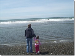
We also enjoy going to the beaches. One of our favorite beaches is Grayland, which is just South of Westport. One can spend hours watching the Ocean, playing in the sand, but remember our Ocean waters are cold so not much swimming is to be had. Up the way there is a lighthouse though that give tours, there is a charge, but it really is very reasonable.
100_27432
100_27582
I could probably overwhelm you with all the things that we have done. There are many back roads to explore, nature trails to hike, and always new things to discover.
If you want to truly experience what we have to offer, then you would want to check out our schedule of events. Most all of these events are free. From Pirate Days, Kite Festivals, Art Festivals, Parades, Car Shows, Loggers Day, The Tall Ships, oh the list could go on and on. Then of course we can’t forget the Grays Harbor Fair.
We’ve lived here 6 years, and we still have not seen nor experienced everything that Grays Harbor has to offer. If you want to take a day trip, you could always visit the Olympic National Forest, the rain forest, Long beach, and let me tell you the drive along the coastline is beautiful just in itself.
I hope that for those of you who are planning on a staycation this year, you will take the time to truly explore everything there is to do in your area. Just do a little research, as you may find something you didn’t even know about.
Pin It

Wednesday, May 18, 2011

Geography/History

geographyhistory_thumb
Since we are taking a little break to enjoy the few days of sunshine we are having, we didn’t do a lesson of any sort for this week. We did get out and play today, I can’t believe it actually reached 60 degrees! That is a lot cooler then the average for here this time of year, but at the same time it felt warmer then that.
Selena did get to watch her first little league baseball game yesterday evening, when I realized that one of her classmates from Sunday school was playing. She had so much fun watching the game. She informed me on our way home, “I want my team and a number on my shirt.” We do want to get her into T-Ball next year. I think she would have a lot of fun learning how to play the game that her and Papa watch so much together.
Link your Geography and History lessons below and I promise when our rains return this weekend through next week, we will be around to read them.
Pin It

Wednesday, May 11, 2011

Geography/History Tid Bits

geographyhistory_thumb

I really wanted to get pictures of all the beauty on our travels today, but unfortunately we were running a little late getting out of here, so I did the driving. Papa tends to drive slower then I do, so when we are running a little late I know better then to ask him to drive. No, I do not speed, I have been known to at one time or another, but with cruise control I am able to just keep my speed and go!

When we hit Aberdeen, Selena looked up the river to see the two tall ships, the Lady Washington, and The Hawaiian Chieftain, who call Aberdeen their home port, with all sails up and sailing up river. Oh at that point I wanted to stop the car and get pictures, but we were on the wrong side of the Highway for that. When we came back through there was only one of the tall ships still in sight, and it was pulled into a cove, hard to get a good picture of.

This did however, open the door for a lot of questions by Selena about Pirates. Are these pirate ships? Were all sailors considered pirates? The questions went on and on, and after every question in her best pirate voice she had to say ARG! I just discovered that they are giving tours of the ships tomorrow, and hope to take Selena down, then we will get pictures and many of her questions answered. I will share more about that if we are able to get down there for a tour.

I did however, turn this around and asked Selena what were some of the other means of travel before the cars and trucks or any motorized form of transportation. She thought about it for a minute and then exclaimed covered wagon. I asked her who traveled by covered wagon, and of course she remembered The Little House on The Prairie and answered with “Laura and Mary.”

When we got home she wanted to build a covered wagon, of course I knew she wanted to build one like this one.

100_3861_thumb1 Since it was late, and about time for bedtime, I chose to build one she could sit in and truly enjoy. With two chairs and a blanket, we created a covered wagon that Selena thought was pretty cool.

100_4805 100_4808 I again asked her if she knew of anyone that traveled by wagon? She looked at me and said the pioneers. I then told her that some of her own family had traveled by wagon train from Kentucky to Promise Oregon where they homesteaded. We came to the computer and found a route most commonly used that may have been the same trail our family traveled. I will probably never really know for sure, but I am taking my best educated guess that this is the route they took.

oregon_trail Selena went back to enjoying her covered wagon again until time to get ready for bed. I promised we would rebuild it tomorrow for some more fun. It is so fun when just a few questions can turn a ordinary moment into a time for learning.

Just because I love to share the exciting things that Selena does: While waiting in the doctor’s office a woman acknowledged Selena’s reading ability. She said she use to be a Kindergarten teacher. Selena turned and just started telling her all about bees, from them flying into the bee hive, collecting nectar from flowers and using that to make honey. She then grabbed a bible that was on one of the tables and informed her what the first 10 books of the bible were, in order, and that last Sunday our bible story was from the book of Ruth, which is followed by 1 Samuel and 2 Samuel. I wondered if she was listening in Sunday school, I guess now I know that she is.

Now it is your turn to share with us what you have studied in Geography or History in your homes this week. Link your post below.

Pin It

Wednesday, May 4, 2011

Geography/History Mississippi

geographyhistory_thumb

Selena had overheard the Pastor’s wife mention that she was from Mississippi, so of course she just had to study Mississippi this week. She went to our wall map and found it with great ease.

100_4798 I asked her how she knew that Mississippi was located there on the map. Her answer cracked me up, “Carrie always says she is from down South, so I guessed Mississippi was at the bottom of the map.” Good answer!

100_4799 Again Selena found Mississippi very easily on her outline map. I asked her what color she was going to color it, she informed me brown. I asked her why brown since there wasn’t any brown in the State flag, she again referred to Carrie, and said “Because Carrie was wearing a brown dress on Sunday.” Do you think Selena likes Carrie?

100_4800 Selena proceeded to read Mississippi from the map I printed out, she called it “The Madenole State.” Pretty close since it is The Magnolia State. That was quite a word for her to try to pronounce and read.

Mississippi Mississippi2 Selena helped assemble her scrapbook pages. Remarking after we had looked up interesting information about Mississippi that a lot of States have Milk as their drink, but that is a good thing as she loves milk. She also commented on the Largemouth Black Bass as the State fish, stating that Papa would love to catch one of those. At this point Selena lost interest, and grabbed hoppy to go off and do something else.

Now it is your turn to share with us what you are studying in your home in Geography or History. Link your post up below.

Pin It

Wednesday, April 27, 2011

Geography/History Busy Little Bees

geographyhistory_thumb

For some reason we awoke this morning and I suddenly realized that the end of the month is here. I wanted to fit a geography lesson in, but Selena informed me she didn’t want to study a State this week, which truly was fine with me. With all the festivities of Good Friday, and Easter, I neglected to design the May bulletin board for the church. I guess you can see that this is becoming my regular job, that is ok I love this type of creativity. There is so much to do with a meeting tomorrow with the Children’s Ministries, and I still have to get my Sunday School material ready to go for Sunday.

We did however find some time for some fun. Selena was asking all day for me to build her a house. She wanted a lego house. She still doesn’t do much with her legos on her own, but she loves it when I will sit down and build something for her. Her only complaint is it takes too long.

100_4763 100_4764 100_4765 After Selena made her contributions we had this.

100_4766

I also took time today to work on the Mother’s Day craft for all the kids at the church. I took the idea from Ticia at Adventures of Mommydum when they studied Georgia and the Trail of Tears. I thought the cards her children made were very pretty. Though she had a punch to make her pedals, I instead used a heart shaped foam sticker for my pattern.

100_4767 100_4768

All the children will make one of these, and while we are talking about families this month, starting with the story of Moses, the children will be asked to list at least three things they can do at home to help out.

We are still interested in exchanging postcards, so anyone who would like to exchange with us please leave a comment with a way for me to get in touch with you. Also if you do not feel comfortable giving out your personal information, but would be willing to send Selena a postcard, she would greatly appreciate that, we still have a lot of States that we would love to get postcards for. Just let us know by leaving a comment, again please make sure there is a way for me to contact you if you have your email disabled.

I also want to put a plug in for another family looking to swap postcards with anyone. You will not be disappointed, I know we sure were not when we received so many postcards from the same family along with some Braille sheets to study so we can explore how to read Braille. If your interested in swapping postcards with them, then head on over to Traci’s Teaching Times and just let her know.

Now it is your turn to link up what you have been studying this week in Geography and History in your homes.

Pin It